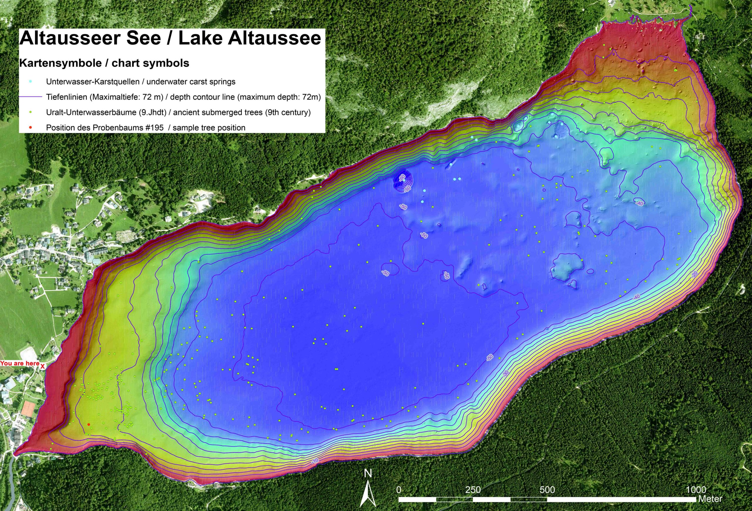
Bathymetry of Lake Altaussee showing locations of ancient submerged trees, underwater spring pits, and scattered boulders
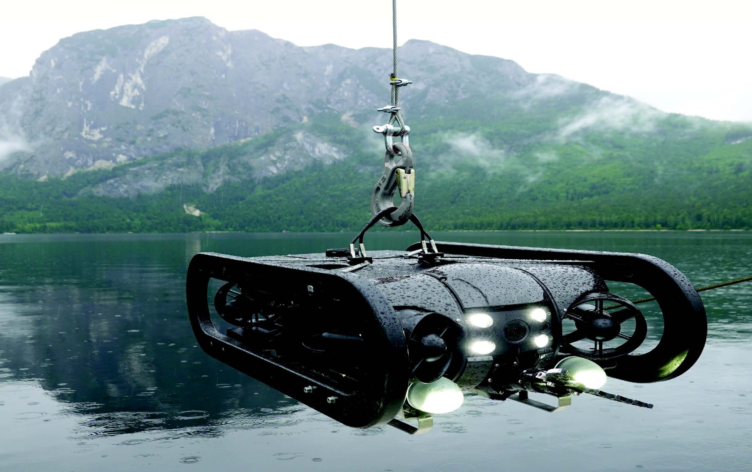
A precise 3D model of the lake basin was created using echo sounder depth measurements (BATHYMETRY). Rescue divers from the fire brigade in Altaussee used an underwater robot (ROV) with a gripper arm to take samples from the bottom structures, such as submerged trees and funnelshaped karst springs.
Remote Operating Vehicle (ROV) equipped with gripper arm and multi-sensor unit
The vast majority of the lake’s water supply comes from these underwater springs, which are fed by the karst plateau of the surrounding Totes Gebirge mountains. Snow melt and heavy rains cause huge amounts of water flow through caves (Liagern, Kugelmühle), feeding Lake Altaussee from occasional waterfalls in the cliffs and through spring pits in the bottom of the lake.
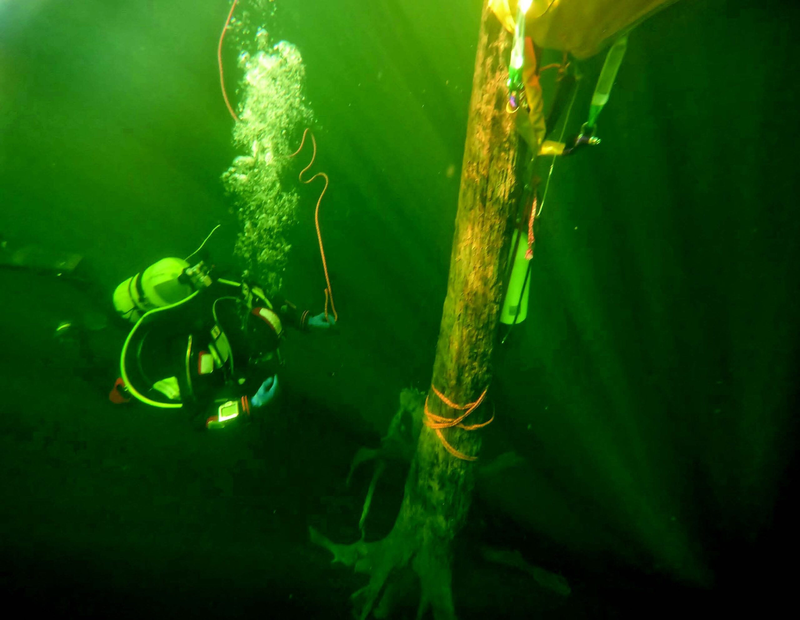
Rescue divers from the fire brigade in Altassee support the
scientists by taking samples
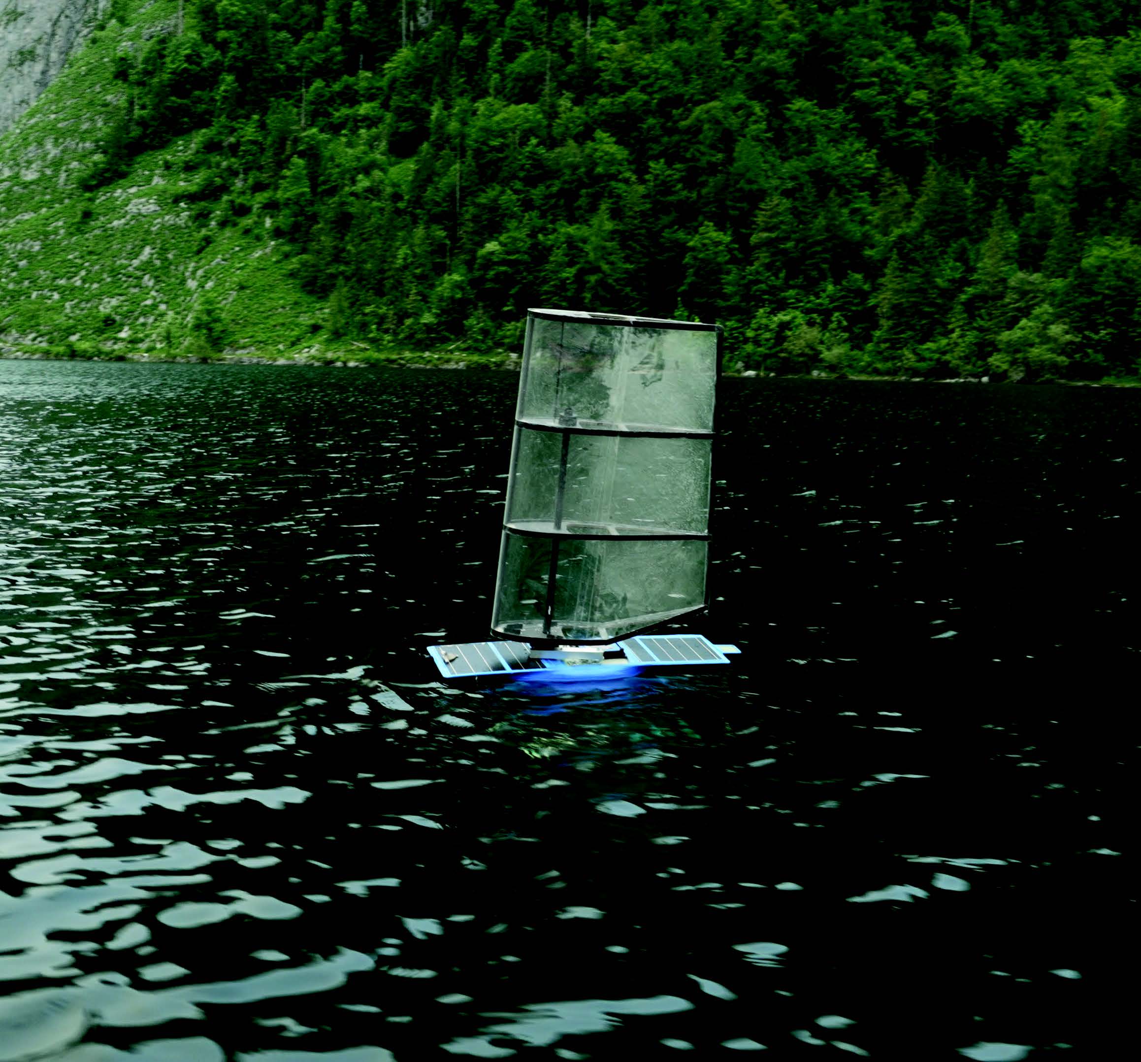
The autonomous semi-submersible sailing vehicle, “SubSeaSail,” was used to carry out high resolution acoustic tomography. This technique, originally pioneered by Walter Munk, uses the propagation of sound through the lake to measure the temperature and salinity of the water.